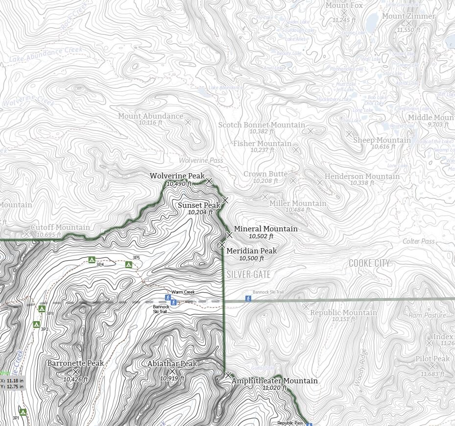


Yellowstone National Park, Slough Creek - Lamar River
The first of our detailed area maps of Yellowstone National Park. This one covers the northeast region of the park including Slough Creek and the Lamar River with detail extending past the park.
See below for descriptions on our three signature styles, especially for the 11”x14” size as the “all the things” style is different for this size due to the level of details. If you’re interested in the most amount of detail, we suggest the 24”x36” - in the smaller sizes the number of lake labels in the Absaroka-Beartooth Wilderness area in the northeast portion of the map decrease.
Prints are shown framed for display purposes only.
Slough Creek - Lamar River, Yellowstone National Park!
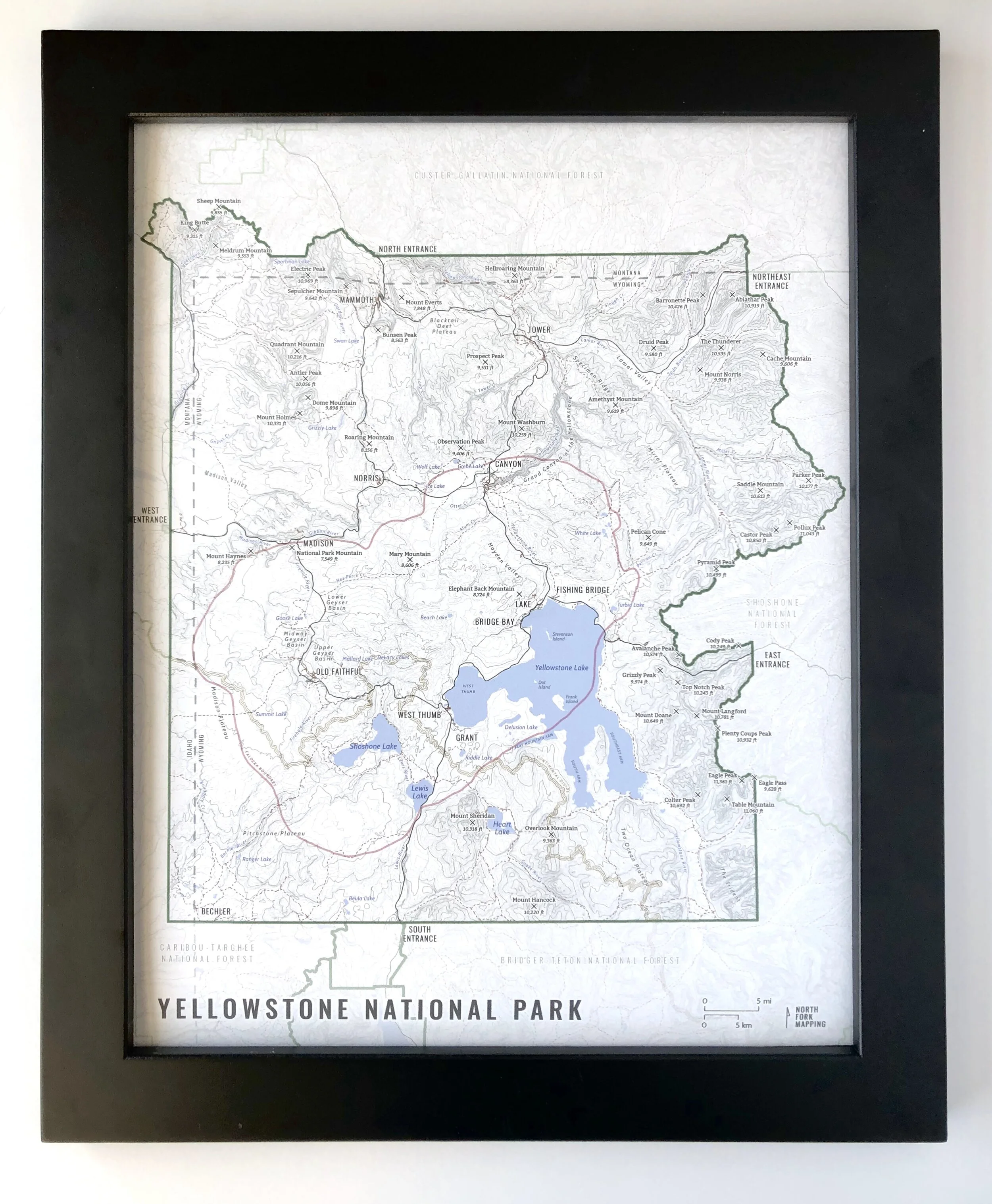
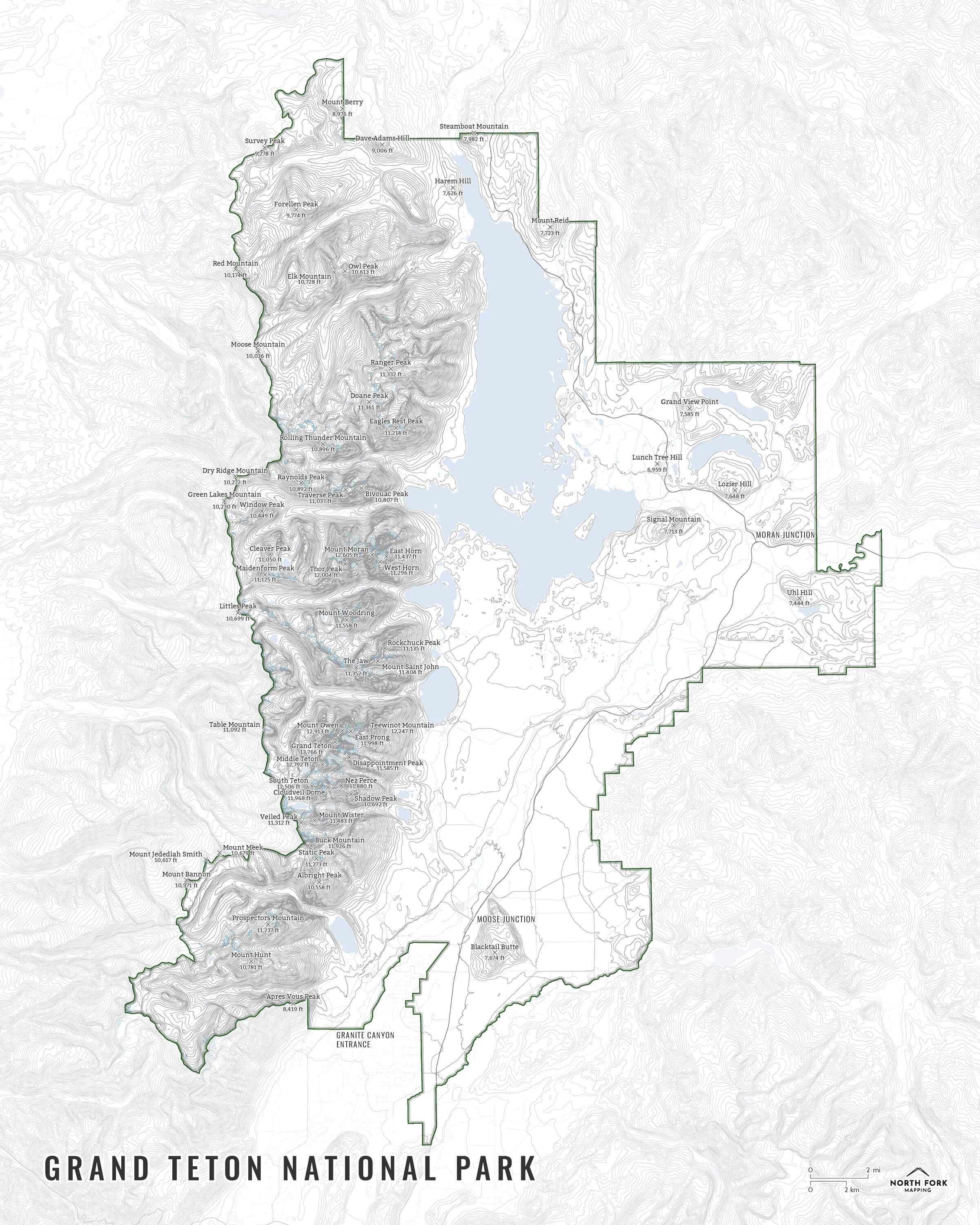
We have three signature styles of map depending on what you’re looking for:
“Minimalist” - Title and topo lines with a very faint road network underneath for reference as well as hydrology and the Yellowstone boundary. Clean, simple, elegant. More of an “art” look than a “map” look.
“Just The Basics” - Adding onto the minimalist style with summit names and elevations and developed areas as well as a scale bar. A basic map.
“All The Things” - Just as it sounds. The mappiest of them all. Adding forest service boundaries and labels, state boundary and labels, common place names, lake labels, stream labels, trails, contour labels, park trailheads, campsites, and cabins, and other elements. In the 11”x14” size, due to the amount of data can fit in, the “all the things” style does not include campsites, trailheads, or backcountry cabins inside the park and doesn’t include lake labels outside of the park.